
| PG: OBJECTS: PROMOTION: Aldenham 79 and Elstree 60 BOAT Tykeswater Lane | |
| Aldenham Parish Ride: Clockwise: Butterfly Lane, Dagger Lane, Hogg Lane then Aldenham 78. Anti-clockwise: Theobald Street then Elstree 49 and Shenley 45. | APR |
| The Theobald Street end of Tykeswater Lane is subject to a Temporary Traffic Regulation Order, effective 29 Apr 24 and valid for up to 4 weeks within a six month period. Do not use in this period if the route is marked on site as closed. It is to allow construction of a better river crossing. | |
 Annotated map reproduced courtesy of Googlemaps. |
Tykeswater Lane is an old road running from Watling Street (opposite Butterfly Lane) to Theobald Street, almost opposite Elstree 49 restricted byway which leads to Woodhall Lane, Shenley.
This route forms part of the Aldenham Parish Ride, a community circuit surrounding Aldenham Parish and worked on by the Patchetts Green Riding Club and the British Horse Society since 1990. It subsequently formed part of the Greenway from Bushey to Shenley, as part of the Watling Chase Greenways Pilot Scheme. At the time of the BHS 2022 Access Survey (31 Jul 22), there were no gates were across the path and it was signposted at each end. There is one ford (with adjacent footbridge for foot traffic) and one underbridge for the railway crossing. |
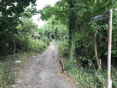 View from Watling Street Photo: Helen Taylor, 31 Jul 2022 |
||
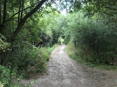 Continuing North along route Photo: Helen Taylor, 31 Jul 2022 |
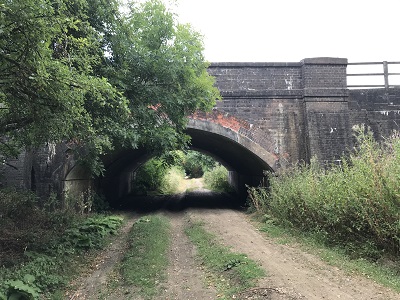 Railway Underbridge (good headroom) Photo: Helen Taylor, 31 Jul 2022 |
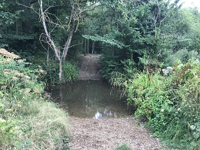 Ford over Tykeswater Photo: Helen Taylor, 31 Jul 2022 |
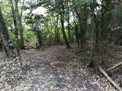 View from Theobald Street Photo: Helen Taylor, 31 Jul 2022 |
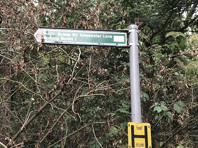 Sign at Theobald Street Photo: Helen Taylor, 31 Jul 2022 |

 We applied for this route to be recorded for equestrian use in 1991. It was finally confirmed as a byway, which means of course that it can be ridden, on 23 March 2005. The work to get this path recorded has taken 14 years! | ||||
| The following photographs showed the route prior to the removal of the obstructions, in 2005. | ||||
 View from Watling Street 29 Mar 2005 |
 Fallen sapling for removal 29 Mar 2005 |
 Fallen sapling for removal 29 Mar 2005 |
 Stile for removal 29 Mar 2005 |
 Stile for removal 29 Mar 2005 |
 View along lane 29 Mar 2005 |
 Kissing gate for removal 29 Mar 2005 |
 View along lane 29 Mar 2005 |
 Kissing gate for removal 29 Mar 2005 |
 Looking towards Theobald Street, under the railway arch 29 Mar 2005 |
|
Long Legal Process - but Worth the Wait
The second application was made in April 1996. By then, Hertfordshire County Council had taken on a number of additional definitive map staff, and they managed to find additional evidence in the county record office. A new order was made in October 2003. There were, of course, objections. These were eventually withdrawn, and the order was finally confirmed by the Secretary of State on 23 March 2005. So, it was 14 years from the initial application to confirmation, but it produced another 3/4 mile of byway available for riding. | ||||
|
| |||||||||||||||||||||||||||||||||||||
© 2025 Patchetts Green Bridleways Trust.
File reference: EC072.
HCC reference: HTM/49 & 53
