Paths Greenways Bridleways Tracks
 PG: OBJECTS: PROMOTION: Caddington 40 RB - Tipple Hill Road
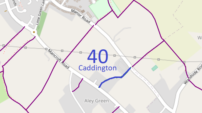
Map showing recorded paths
Map data from © OpenStreetMap and Central Bedfordshire Council.
This route runs from Mancroft Road generally northeastwards to Manor Road.

We need a volunteer to photograph this route for the Access and Riding Rights of Way Survey. It's easy - just take photographs (safely) when you use the path. Find out more!
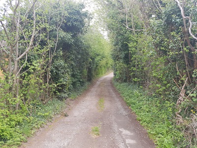
Photograph of Caddington 40
View from Mancroft Road
Photo: Phil Wadey, 28 Apr 2019
BHS PGBT As part of the Patchetts Green Bridleways Trust’s and the British Horse Society’s work to record paths before Path Extinguishment Day, it was spotted that Caddington 40 appeared to be an old road rather than a bridleway, so an application was made in 2019 to record the route as a restricted byway. The Central Bedfordshire Council turned down the application, but the Secretary of State agreed that the evidence was sufficient that an order should be made. Although the Secretary of State directed that the order be made within 3 months, the Council took a year to make and publish the upgrade order. This was made, and subsequently confirmed as an unopposed order. This is a good example of 'perfectly obvious paths' that would be extinguished by the Countryside and Rights of Way Act 2000 if an application had not been made in time.

Legal History
11 Feb 2019: Application made to record as restricted byway. Council reference: 57.
2 Jun 2023: Central Bedfordshire Council decided not to make an order to record as restricted byway.
3 Jun 2023: Notice of appeal sent to Central Bedfordshire Council and the Secretary of State. PINS reference ROW/3323544.
4 Apr 2024: Appeal granted by an Inspector. Order for RB is to be made within 3 months. PINS reference ROW/3323544.
9 May 2025: The Central Bedfordshire Council (Definitive Map and Statement for Central Bedfordshire) (Caddington: Restricted Byway No.40) Modification Order 2025, made 9 May 2025 and confirmed 28 Nov 2025, upgraded Caddington 40 bridleway to restricted byway.
Application Process
Path Application Certificate Determination Appeal Order Confirmed
EB903 11 Feb 2019 CBC 57 28 Apr 2019 No order, 2 Jun 2023 Granted, 4 Apr 2024 9 May 2025 28 Nov 2025
Prospective Definitive Statement (6 May 2025)
Path: Caddington Restricted Byway No. 40.
From: Manor Road.
To: Mancroft Road. Description
The Path is a restricted byway.
It starts at its junction with Manor Road, Caddington at Ordnance Survey Grid Reference (OS GR) TL 0684 1864 and extends in a south-westerly direction for approximately 94 metres along a track known as Tipple Hill Road to OS GR TL 0678 1858 then continues in a generally westerly direction for approxumately 46 metres along the road to OS GR TL 0674 1858 then continues in a generally south-westerly direction for approximately 126 metres along the road to terminate at its junction with Mancroft Road, Caddington at OS GR TL 0663 1851.
Restricted Byway No. 40 Caddington has a variable width of between 4.0 metres and 7.5 metres, with a width of 5.9 metres at OS GR TL 0684 1864 narrowing to 4.6 metres, a width of 7.5 metres at OS GR TL 0678 1858, a width of 4.4 metres at OS GR TL 0676 1858, a width of 4.3 metres at OS GR TL 0674 1858, a width of 5.7 metres at OS GR TL 0670 1856 and a width of 7.1 metres at OS GR TL 0663 1851, the width being more particularly defined by its depiction on the Ordnance Survey 25":1 mile map (2nd Edition) of 1901 for Bedfordshire (sheet XXXII. 12).
Maintainability
This route is maintainable at the public expense because it was a highway before 1835.

© 2025 Patchetts Green Bridleways Trust. File reference: EB903. CBC reference: 57.

Stats2