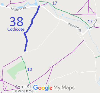
Annotated map reproduced courtesy of Googlemaps.
We need a volunteer to photograph this route for this year's Access and Riding Rights of Way Survey. It's easy - just take photographs (safely) when you use the path. Find out more!
 This route had been ridden for many years, but the equestrian rights were brought into question when a sign appeared on the route saying, 'No Horses', in 2000.
As a result BHS volunteers collected user statements to show that the route had been used as of right for many years.
An application to record the route as a bridleway was made. The landowner offered a permissive bridleway, but the evidence was strong.
The County Council agreed with the application. An order was made in 2006 and confirmed unopposed.
