Paths Greenways Bridleways Tracks
 PG: OBJECTS: PROMOTION: Hemel Hempstead 13 BOAT
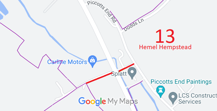
Map showing recorded Hemel Hempstead paths
Annotated map reproduced courtesy of Googlemaps.
This route starts on Piccotts End Road (public road) and runs generally westwards to cross Leighton Buzzard Road (public road). It then continues generally westwards to stop at the junction with Hemel Hempstead 12 footpath.

At the time of the BHS 2022 Access Survey (14 Aug 22), the route was unobstructed save for bollards preventing wide motor vehicles. The signage said 'footpath' at the junction with Footpath 12 and at Piccotts End Road, which is incorrect, but correctly said 'byway' at the junction with Leighton Buzzard Road.
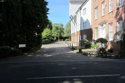
Photograph of Hemel Hempstead 13 path
Piccotts End Road looking West
Photo: Brian Worrell, 8 Aug 2022
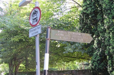
Photograph of Hemel Hempstead 13 path
Signs at Piccotts End Road
Photo: Brian Worrell, 8 Aug 2022
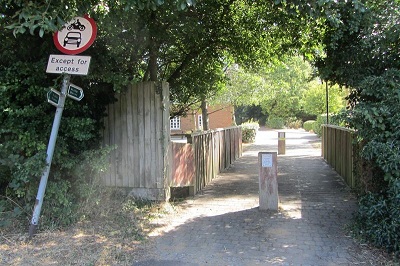
Photograph of Hemel Hempstead 13 path
Leighton Buzzard Road looking East
Photo: Brian Worrell, 8 Aug 2022
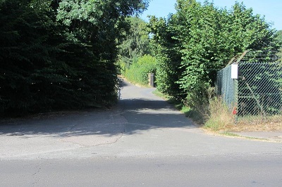
Photograph of Hemel Hempstead 13 path
Leighton Buzzard Road looking West
Photo: Brian Worrell, 8 Aug 2022
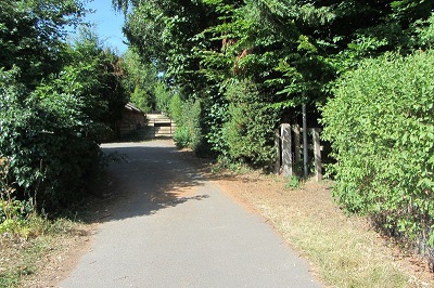
Photograph of Hemel Hempstead 13 path
Continuing West and change to FP
Photo: Brian Worrell, 8 Aug 2022

Legal History
20 Jun 1953: The route was recorded as part CRB (Carriage Road used as a Bridleway) and part footpath on the original definitive statement, but CRB has been hand-marked up as 'byway' on the definitive statement. DM sheet DM3-xx (Herts 33 NE).
31 Dec 1977: The route was shown as part byway open to all traffic and part footpath on the special review draft map and statement. DM sheet SR-65.
28 Jul 1989: The Borough of Dacorum (Byway Open to All Traffic, Hemel Hempstead No.13) (Prohibition of Driving) Order 1989 prohibits motor vehicles between Leighton Buzzard Road and Piccotts End Road except for access.
Definitive Statement (4 Dec 2015)
Path: [Hemel Hempstead] 13.  Status: Byway Open to All Traffic and Footpath  Definitive Map sheet: 65
Commences at junction with county road at Piccotts End as BOAT thence SW across county road across FP12 and continuing as a FP past N side of Warnersend Wood. Exit by gap in hedge to Fennycroft Road.
Maintainability
This route is maintainable at the public expense by virtue of para 7 of Sch 3 to the Countryside Act 1968. [Converted from RUPP]

© 2024 Patchetts Green Bridleways Trust.

Stats2