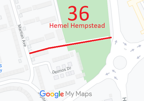
Annotated map reproduced courtesy of Googlemaps.
A volunteer has photographed this route for the 2023 Access and Riding Rights of Way Survey, and the page will be updated shortly. Find out more!
| Paths Greenways Bridleways Tracks | ||
| PG: OBJECTS: PROMOTION: Hemel Hempstead 36 RB | ||
Annotated map reproduced courtesy of Googlemaps. |
This route runs from Martin Avenue (public road) generally eastwards to Redbourn Road (public road).
A volunteer has photographed this route for the 2023 Access and Riding Rights of Way Survey, and the page will be updated shortly. Find out more! |
|
| ||||||||||
© 2024 Patchetts Green Bridleways Trust.
