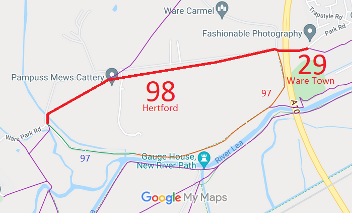
Annotated map reproduced courtesy of Googlemaps.
We need a volunteer to photograph this route for this year's Access and Riding Rights of Way Survey. It's easy - just take photographs (safely) when you use the path. Find out more!
| Paths Greenways Bridleways Tracks | ||
| PG: OBJECTS: PROMOTION: Hertford 98 and Ware Town 29 RB | ||
Annotated map reproduced courtesy of Googlemaps. |
This page is still being prepared.
We need a volunteer to photograph this route for this year's Access and Riding Rights of Way Survey. It's easy - just take photographs (safely) when you use the path. Find out more! |
|||
| Legal History Oct 1999: Landowner enquiry to HCC about downgrading to FP, but no application made. HCC ref EH/191/DISC. 2 May 2006: Restricted Byway rights were confirmed or created on this path by virtue of ss 47 and 48 Countryside and Rights of Way Act 2000. |
Definitive Statement (4 Dec 2015)
Path: [Ware Town] 29. Status: Restricted Byway. Definitive Map sheet: 59 Commences from Park Road Lodge, Ware Park, thence to parish boundary on bridge over A10 and junction with Hertford Restricted Byway 98. (former Ware Rural RUPP43). Path: [Hertford] 98. Status: Restricted Byway.
Definitive Map sheet: 59 |
© 2022 Patchetts Green Bridleways Trust.
File reference: EC301. HCC reference EH/191/DISC.
