
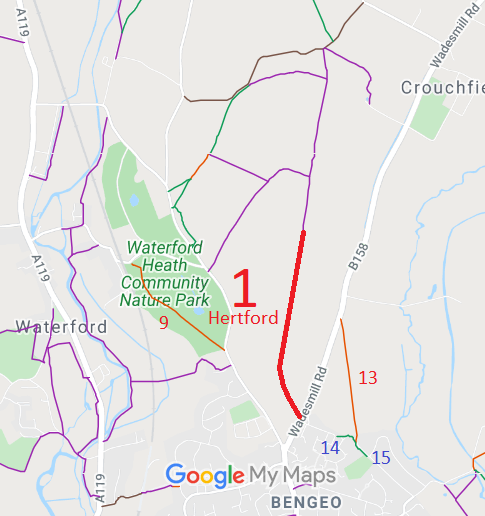
- Hertford 1 RB off Wadesmill Road
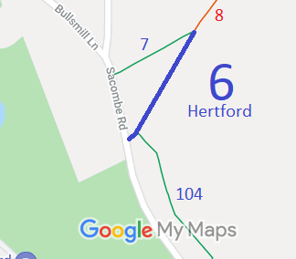
- Hertford 6 BW from Sacombe Road to Hertford 8 BW
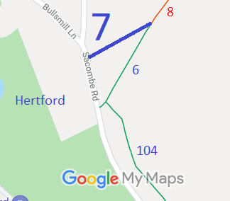
- Hertford 7 BW from Sacombe Road to Hertford 8 BW
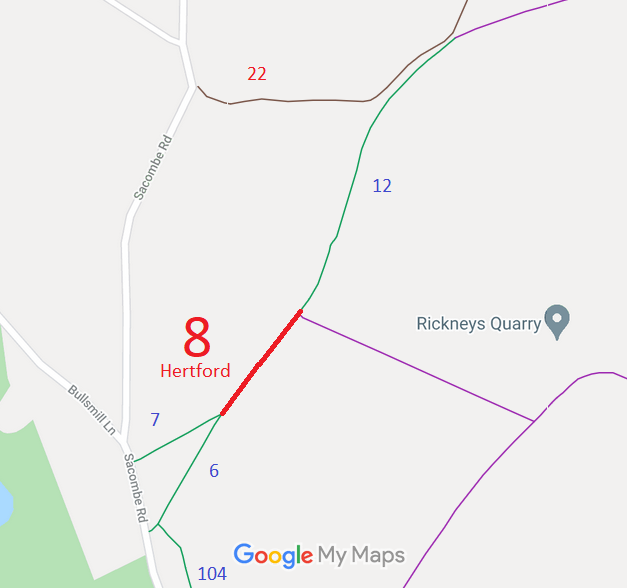
- Hertford 8 RB from BW 6 & 7 to Chapmore End
- Hertford 9 RB from Borough Boundary to Sacombe Road
- Hertford 10 RB from Cowper Crescent to Great Molewood
- Hertford 12 BOAT, from FP 11 to North Road
- Hertford 13 RB, from Wadesmill Road to BW 14
- Hertford 14 BW, from RB 13 to Watermill Lane
- Hertford 15 BW, from RB 13 & BW 14 to Watermill Lane
- Hertford 43 RB, from A414 to London Road
- Hertford 46 BW, from Morgans Road to Hertford Lodge
- Hertford 47 BW, from Hertford Lodge to Brickendonbury
- Hertford 49 BW, Brickendon Lane, from Morgans Walk to borough boundary
- Hertford 54 BOAT, from West Street under viaduct to FP55
- Hertford 56 BOAT, from FP55 to road by disused railway station
- Hertford 57, Hertingfordbury 2 and Little Berkhamsted 25 BW
- Hertford 61 BW - now renumbered to Hertford 117
- Hertford 97 BW/RB, from RB98 to RB98
- Hertford 98 and Ware Town 29 RB, from Park Road Lodge to Mill Stream
- Hertford 104 BW, from Sacombe Road to Hertford 6 BW
- Hertford 112 BW, from Mangrove Road to London Road
- Hertford 113 BW, from Hertford 112 BW to London Road
- Hertford 114 BW, from Mangrove Road to Hertford 112 BW
- Hertford 117 and Hertingfordbury 12 BW, from Thieves Lane to Welwyn Road
- Hertford Kings Mead common land
- Hertford 94 Thieves' Lane
- Hertford 60 off Hertingfordbury Road
- Hertford CGW6 Part 6 of the Cole Green Way

Annotated maps reproduced courtesy of Googlemaps.



 Local Government: Formerly Hertford Borough.
From 1974, part of East Hertfordshire District.
Inclosure (1808). Tithe (Hertford All Saints) (1847) DP/48/27/1B. Tithe (Hertford St Andrew) (1838) DSA4/50/2. Tithe (Hertford St John) (1847) DP/48/27/1C. Inclosure (1864).

