Paths Greenways Bridleways Tracks
 PG: OBJECTS: PROMOTION: Hertingfordbury 12 BW and Hertford 117 BW
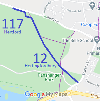
Map showing Hertingfordbury 12 Bridleway
Annotated map reproduced courtesy of Googlemaps.
This route runs from Thieves Lane (public road) to the B1000 Welwyn Road (public road) and a crossing to the B1000 Verge Path which leads to Hertingfordbury 11 bridleway.

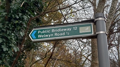
At the time of the 2023 Access Survey (26 Nov 23), there was one horse stile across the path and it was signposted at each end.
Photograph of Hertingfordbury 12 bridleway
Sign on Thieves Lane
Photo: Phil Wadey, 26 Nov 2023
Photograph of Hertingfordbury 12 bridleway
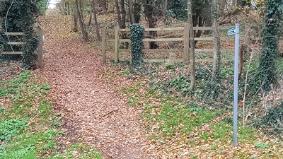
View from Thieves Lane
Photo: Phil Wadey, 26 Nov 2023
Photograph of Hertingfordbury 12 bridleway
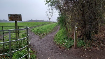
Gap from Woods to Field
Photo: Phil Wadey, 26 Nov 2023
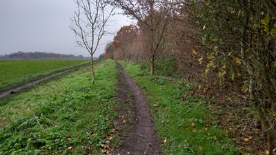
Photograph of Hertingfordbury 12 bridleway
Continuing NW in Field
Photo: Phil Wadey, 26 Nov 2023
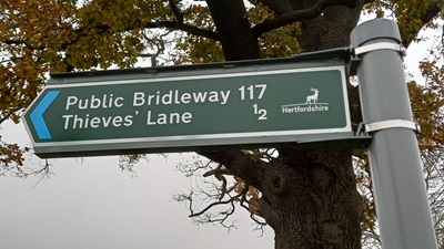
Photograph of Hertford 117 bridleway
Sign on Welwyn Road
Photo: Phil Wadey, 26 Nov 2023
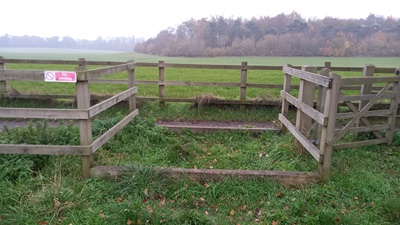
Photograph of Hertford 117 bridleway
Horse Stile seen from Welwyn Road
Photo: Phil Wadey, 26 Nov 2023

Legal History
2 Feb 1953: Hertingfordbury 12 was recorded as a Bridleway on the original definitive map and statement.
1 Sep 1982: The Hertfordshire County Council (Footpath 61 Hertford and Bridleway 12 Hertingfordbury) Public Path Diversion Order 1982 was made under the Town and Country Planning Act 1971.
3 Sep 1982: London Gazette announcement of making the order.
5 Apr 2012: The Panshanger (South of the B1000) Public Path Creation Agreement 2017 was made by the Hertfordshire County Council and the Tarmac Aggregates Limited. This upgraded part of Hertford 61 FP to BW and added a section of BW. The bridleway was renumbered 117 leaving the un-upgraded part of Hertford 61 as footpath. HCC reference EH/70/CRE.
14 Dec 2018: The Hertfordshire County Council (Hertford 61 and 117) Legal Event Modification Order 2018 recorded the effects of the 2012 creation agreement on the definitive map and statement.
Definitive Statement (4 Dec 2015)
Path: [Hertingfordbury] 12.  Status: Bridleway.  Definitive Map sheet: 59
Commences at junction with Thieves Lane thence NW through Chesher's Plantation to the junction with Hertingfordbury 32 at TL 3059 1261 then NW through Blackmore Wood to parish boundary and junction with Hertford BR 117 at TL 3034 1297.

Path: [Hertford] 117.  Status: Bridleway.  Definitive Map sheet: 59
Commences at the parish boundary and junction with Hertingfordbury BR 12 at TL 3034 1297 and continues generally NW between the hedges for approx 130m to the copse and junction with Hertford 61 FP at TL 3028 1309, then generally WNW and NNW along the field edge on the outside of the copse for approx 100m to TL 3021 1314, then generally NW along field edge on the S side of the hedge for approx 120m to join the Hertford Road/B1000 (public road) on the E side of the oak tree at TL 3010 1318.
Width: 4m
Limitations: None

Maintainability
Part of the route is maintainable at the public expense because it was a footpath or bridleway existing before 30 Apr 1959.
The rest of the route is maintainable at the public expense by virtue of s.36(2)(d) Highways Act 1980 as it was created by a Public Path Creation Agreement. [Dedicated by PPCA]

© 2024 Patchetts Green Bridleways Trust.

Stats2