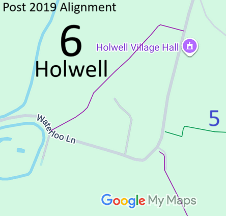
Legal History
1938: The pre-2019 route is shown as Holwell 7 FP (red dots) on the Hertfordshire County Council ROW survey. Map Hitchin Rural West 4 (Herts 6 SE).
20 Feb 2019: The North Herts District Council (Holwell 6) Public Path Diversion Order 2019, confirmed 9 Apr 2019, diverted Holwell 6 footpath under s.257 Town and Country Planning Act 1990.
|
|
Definitive Statement (4 Dec 2015)
Path: [Holwell] 6. Recorded Status: Footpath.
Definitive Map sheet: 11
Commences from Pirton - Holwell road NW of Village Hall thence W for approx. 33 yards
thence SW to rejoin road opposite Moat Farm.
|
Maintainability
The original route was maintainable at the public expense because it was a footpath or bridleway existing before 30 Apr 1959.
The diverted route is maintainable at the public expense by virtue of s.36(2)(d) Highways Act 1980. [Public Path Diversion Order]
|
|