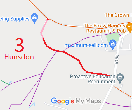
Legal History
2 Feb 1953: Hunsdon 3 was recorded as CRB (Carriage Road used as a Bridleway) on the original definitive statement. DM sheet DM2-26 (Herts 30 SW) and DM2-27 (Herts 30 SE).
31 Dec 1977: The route was shown as a byway on the special review draft map and statement. DM sheet SR-61 (TL41SW), but there must have been objections as the 1986 map showed it still as a RUPP.
1 Jun 1991: Hunsdon 3 was shown as part byway part RUPP on the 1991 consolidated definitive map and statement. DM sheet DM1991-61.
1 Apr 2017: Landowner application to downgrade the section shown as BOAT to RB. HCC reference EH/456/MOD.
13 Dec 2021: Secretary of State directed Hertfordshire County Council to determine the application by 13 Jun 2022. PINS reference FPS/M1900/14D/28.
21 Sep 2023: Hertfordshire County Council Investigation report issued.
11 Apr 2024: The Hertfordshire County Council (Hunsdon 3) Modification Order 2024 (confirmed 18 Jul 2024) altered the byway to restricted byway on the definitive map and statement.
|
| Application Process |
| Path |
Application |
Certificate |
Direction |
Inv Report |
Order |
Confirmed |
| EC1000 |
1 Apr 2017 EH/456 |
28 Mar 2017 |
13 Dec 2021 |
21 Sep 2023 |
11 Apr 2024 |
18 Jul 2024 |
|
Definitive Statement (22 Mar 2024)
Path: [Hunsdon] 3. Status: Restricted Byway.
Definitive Map sheet: 61
Commences from RB 12 at TL 4100 1414 then SSW past Fillets Farm for approx. 130m then SE for approx 740m, passing two junctions with FP 6 (to S, then to N), then continuing to meet Stanstead Road (public highway) at TL 4155 1368.
Width: Varies between 4m and 18m as shown in the Hertfordshire County Council (Hunsdon 3) Modification Order 2024.
Limitations: None
|
Maintainability
This route is maintainable at the public expense because it was a highway before 1835.
|
|