Legal History
1910: This section of Hunsdon 6 is noted as 'B.R.' on the second edition OS map of the area.
2 Feb 1953: Hunsdon 6 was recorded as footpath on the original definitive statement. DM sheet DM2-26 (Herts 30 SW) and DM2-27 (Herts 30 SE).
31 Dec 1977: Hunsdon 6 was shown as a footpath on the special review draft map and statement. DM sheet SR-61 (TL41SW).
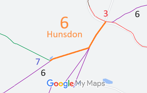
11 May 2016: Hertfordshire County Council consulted on a proposal to upgrade Hunsdon 6 to bridleway and divert it to the field edge. Unfortunately, opposition from some user representatives meant that this could not proceed.
|
Definitive Statement (4 Dec 2015)
Path: [Hunsdon] 6. Recorded Status: Footpath.
Definitive Map sheet: 61
Commences from county road opposite the "Fox and Hounds" P.H. thence N and SW to
junction with Restricted Byway 3 (Filletts Lane). Recommences from Restricted Byway 3
approx 50m W of previous junction thence SW to parish boundary to join FP6a (Stanstead
Abbotts).
|