Paths Greenways Bridleways Tracks
 PG: OBJECTS: PROMOTION: Kimpton 21 FP and St Paul's Walden 20 FP - under investigation for BW rights
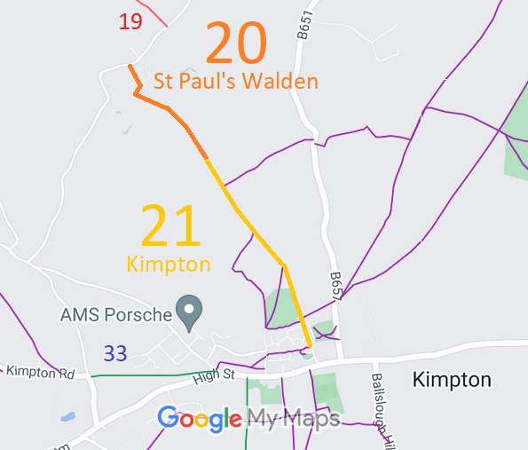
Map showing recorded Kimpton and St Paul's Walden paths
Annotated map reproduced courtesy of Googlemaps.
This route starts from Church Lane, Kimpton (public road) and continues generally northwestwards to end at The Holt on the public road.

At the time of the 2023 Access Survey (13 Aug 23), the path was obstructed to equestrians with several stiles and gates. It was signposted at each end as a footpath.
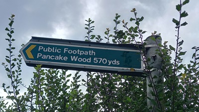
Photograph of St Pauls Walden 20 and Kimpton 21
Sign at Northern End
Photo: Phil Wadey, 13 Aug 2023
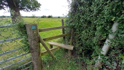
Photograph of St Pauls Walden 20 and Kimpton 21
Stile at Northern end
Photo: Phil Wadey, 13 Aug 2023
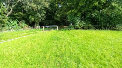
Photograph of St Pauls Walden 20 and Kimpton 21
Continuing Southeastwards
Photo: Phil Wadey, 13 Aug 2023
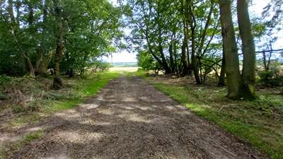
Photograph of St Pauls Walden 20 and Kimpton 21
Wooded area N of parish boundary
Photo: Phil Wadey, 13 Aug 2023
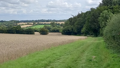
Photograph of St Pauls Walden 20 and Kimpton 21
Continuing Southeastwards
Photo: Phil Wadey, 13 Aug 2023
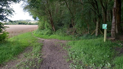
Photograph of St Pauls Walden 20 and Kimpton 21
Continuing Southeastwards
Photo: Phil Wadey, 13 Aug 2023
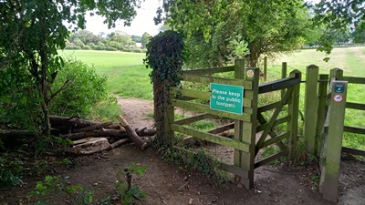
Photograph of St Pauls Walden 20 and Kimpton 21
Continuing Southeastwards
Photo: Phil Wadey, 13 Aug 2023
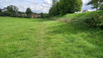
Photograph of St Pauls Walden 20 and Kimpton 21
Continuing Southeastwards
Photo: Phil Wadey, 13 Aug 2023
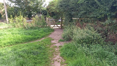
Photograph of St Pauls Walden 20 and Kimpton 21
Continuing Southeastwards
Photo: Phil Wadey, 13 Aug 2023
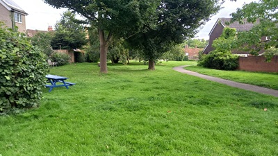
Photograph of St Pauls Walden 20 and Kimpton 21
Continuing Southeastwards
Photo: Phil Wadey, 13 Aug 2023
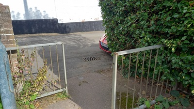
Photograph of St Pauls Walden 20 and Kimpton 21
Junction with Church Lane
Photo: Phil Wadey, 13 Aug 2023

Legal History
1938: The route is shown as a bridleway (blue dots) on the Hertfordshire County Council ROW survey. Maps: Hitchin Rural West 17 (Herts 19 SE) and 18 (Herts 20 SW).
1 Nov 1953: Kimpton 21 was recorded as a footpath on the original definitive map and statement. DM sheet DM4-40 (Herts 20 SW).
1 Nov 1953: St Paul's Walden 20 was recorded as CRF (Carriage Road used as a Footpath) on the original definitive map and statement. DM sheet DM4-39 (Herts 19 SE) and DM4-40 (Herts 20 SW).
31 Dec 1977: The route was shown as a footpath on the special review draft map and statement, although the section in St Paul's Walden clearly shows the use of correcting fluid. DM sheet SR-42.
24 Aug 1979: The Diversion of Highways (County of Hertford) (No.1) Order 1979, made 24 Aug 1979, stopped up a short section of St Paul's Walden 20 and replaced it with an alternative route specified to be a Road Used as a Public Path.
3 Aug 2024: Application for bridleway status. HCC reference NH/358.
Application Process
Path Application Certificate Direction Inv Report Order Confirmed
EC530 3 Aug 2024 NH/358 27 Sep 2024        
Definitive Statement (4 Dec 2015)
Path: [Kimpton] 21.  Recorded Status: Footpath.  Definitive Map sheet: 42
Commences from entry to Garden Fields from Church Lane thence NW along eastern edges of Dovehouse Wood and Park Wood to join BR20 (St Pauls Walden) at parish boundary at Pancake Wood.

Path: [St Paul's Walden] 20.  Recorded Status: Footpath.  Definitive Map sheet: 42
Commences from county road at entrance to The Holt, thence to Grid Ref: TL1690 1959, thence southwards for approximately 40 metres to Grid Ref: TL1688 1955, thence south- eastwards for a distance of approximately 136 metres to Grid Ref: TL1701 1950, thence along western edge of Horsleys Wood to parish boundary.

Statement could usefully reference the junction with Kimpton 21 at parish boundary.

Maintenance
This route is maintainable at the public expense because it was a footpath or bridleway existing before 30 Apr 1959.
Location Information
Postcode for SATNAV for anyone inspecting path: SG4 8RP (Church Lane, Kimpton).

© 2024 Patchetts Green Bridleways Trust. File reference: EC530. HCC reference: NH/358.

Stats2