Paths Greenways Bridleways Tracks
 PG: OBJECTS: PROMOTION: Kimpton and Hyde 15 BOAT - Farrs Lane
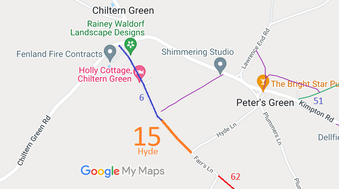
Map showing recorded Hertfordshire paths
Annotated map reproduced courtesy of Googlemaps.
The route runs from the junction of Farrs Lane and Hyde Lane generally northwestwards to end at Hyde 6 bridleway.

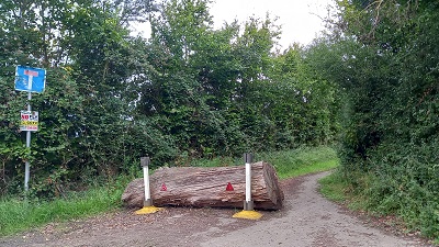
At the time of the Access Survey (22 Dec 2017), no gates were across the path and it was unobstructed throughout, but on 16 Aug 2023 a tree trunk had been placed across the entrance. The tree trunk was still in place 30 Aug 2026.
Photograph of Farrs Lane
Southern end obstuction
Photo: Phil Wadey, 13 Aug 2023
Photograph of Farrs Lane
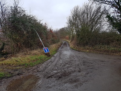
From Farrs Lane/Hyde Lane
Photo: Phil Wadey, 22 Dec 2017
Photograph of Farrs Lane
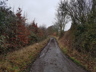
Continuing NW
Photo: Phil Wadey, 22 Dec 2017
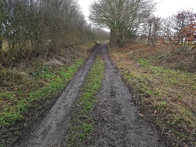
Photograph of Farrs Lane
Continuing NW
Photo: Phil Wadey, 22 Dec 2017
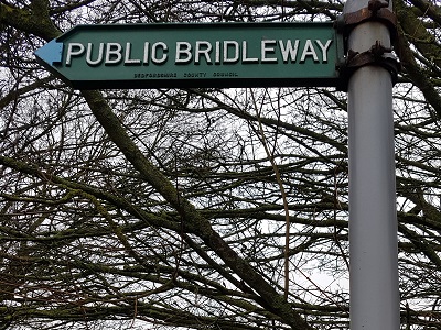
Photograph of Farrs Lane
Sign for Hyde 6 BW at end of Hyde 15
Photo: Phil Wadey, 22 Dec 2017
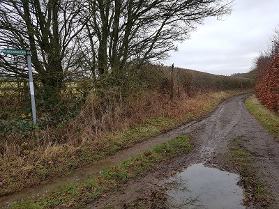
Photograph of Farrs Lane
Looking SE from Hyde 6 BW
Photo: Phil Wadey, 22 Dec 2017

Legal History
2 May 2006: NERC exemption s.67(2)(b) as route not on DM but was on LOS.
9 Feb 2016: Application to record route in Hertfordshire as restricted byway. HCC reference NH/282.
11 Dec 2017: Application to record route in Bedfordshire as byway open to all traffic. CBC reference 53.
8 May 2019: Secretary of State directed Central Bedfordshire Council to determine the application by 8 May 2020. PINS reference FPS/P0420/14D/2.
1 Apr 2022: The CBC (Definitive Map and Statement for Central Bedfordshire) (Hyde: Byway Open to All Traffic No 15) Modification Order 2022 will, if confirmed, add the Bedfordshire moiety of this route to the definitive map for Central Bedfordshire as a byway open to all traffic. The objection period closed 27 Apr 22 and several objections were received by the council.
14 Nov 2024: CBC advise order will have to be remade as the order plan used the wrong notation.
19 Apr 2026: CBC were asked when the remade order would appear.
21 Aug 2026: The CBC (Definitive Map and Statement for Central Bedfordshire) (Hyde: Byway Open to All Traffic No 15) Modification Order 2026 will, if confirmed, add the Bedfordshire moiety of this route to the definitive map for Central Bedfordshire as a byway open to all traffic.
DRAFT Definitive Statement (18 Aug 2026)
Path: [Hyde] 15.  Status: Byway Open to All Traffic.
From Hyde Lane and Farrs Lane to Bridleway No 6, Hyde.
Description:The path is a Byway Open to All Traffic. It starts at its juncton with Hyde Lane and Farrs Lane at Ordnance Survey Grid Reference (OS GR) TL 1389 1876 and extends in a north-westerly direction along the moiety of Farrs Lane situated within Central Bedfordshire for approximately 186 metres to its junction with Bridleway No 6, Hyde at OS GR TL 1376 1890.
Width: Byway Open to All Traffic No 15, Hyde has a variable width of between 2.1 metres and 4.0 metres between OS GR TL 1389 1876 and OSGR TL 1376 1890 and is the moiety of the width of the lane situated within Central Bedfordshire as defined by its depiction on the Ordnance Surey 25":1 mile map (2nd Ed.) of 1901 for Bedfordshire.
Limitations: None.
Maintainability
This route is maintainable at the public expense because it was a highway before 1835.

© 2024-2026 Patchetts Green Bridleways Trust. File reference: EC888 and EB888. HCC reference: NH/282. CBC reference: 53.

Stats2