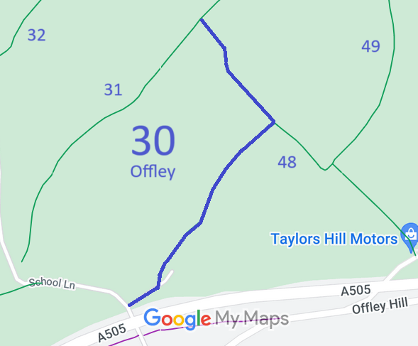
Annotated map reproduced courtesy of Googlemaps.
We need a volunteer to photograph this route for this year's Access and Riding Rights of Way Survey. It's easy - just take photographs (safely) when you use the path. Find out more!
| Paths Greenways Bridleways Tracks | ||
| PG: OBJECTS: PROMOTION: Offley 30 - Stocking Lane | ||
Annotated map reproduced courtesy of Googlemaps. |
This bridleway starts from School Lane (public road) and contniues generally northeastwards to a junction with Offley 48 bridleway, then northwestwards to end on Offley 31 bridleway.
We need a volunteer to photograph this route for this year's Access and Riding Rights of Way Survey. It's easy - just take photographs (safely) when you use the path. Find out more! |
| Legal History 1938: The route is shown mostly as Offley 30 BW (blue dots) and the remainder as Offley 30 green lane (green dots) on the Hertfordshire County Council ROW survey. Map Hitchin Rural West 7 (Herts 11 NE). 9 Nov 2017: Landowner Deposit under s.31(6) Highways Act 1980 admited the part of Offley 30 falling within the relevant land ownership as bridleway. |
Definitive Statement (4 Dec 2015)
Path: [Offley] 30. Status: Bridleway. Definitive Map sheet: 19 Commences from county road opposite Westend Farm thence NE passing W of Eagle's Nest along Stocking Lane thence NW to join BR31. |
© 2024 Patchetts Green Bridleways Trust.