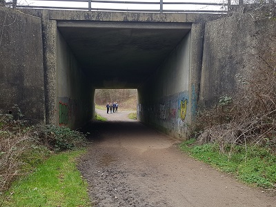
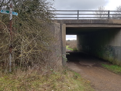
Image of Rickmansworth 10A bridleway taken in 2023 showing track between hedges before it turns to go under the A road
Patchetts Green Bridleways Trust
Rickmansworth 10A


 PG: OBJECTS: PROMOTION: Rickmansworth 10 BW [Spur from BW 10 to BW 61]
London Orbital Bridleroute: Anti-clockwise: Rickmansworth 10. Clockwise: Rickmansworth 61.  H25 
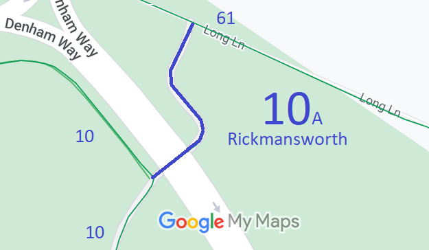
Map showing recorded Rickmansworth paths
Annotated map reproduced courtesy of Googlemaps.
This route starts on the main Rickmansworth 10 BW, and heads north-eastwards under Denham Way before turning north-westwards then north-eastwards to a junction with Rickmansworth 61 bridleway.

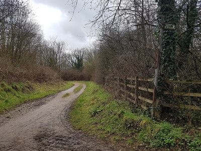
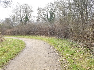
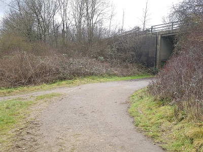
At the time of the 2023 Access Survey (18 Feb 23), the route was unobstructed. It was signed at the southern end but not at the northern end. There is plenty of headroom for horses through the underbridge.

Photograph of Rickmansworth 10 spur bridleway
View from Rickmansworth 61 BW
Photo: Phil Wadey, 18 Feb 2023
Photograph of Rickmansworth 10 spur bridleway
Continuing SW
Photo: Phil Wadey, 18 Feb 2023
Photograph of Rickmansworth 10 spur bridleway
Continuing SE
Photo: Phil Wadey, 18 Feb 2023
Photograph of Rickmansworth 10 spur bridleway
South-west under Denham Way
Photo: Phil Wadey, 18 Feb 2023
Photograph of Rickmansworth 10 spur bridleway
View from Rickmansworth 10 BW
Photo: Phil Wadey, 18 Feb 2023
BHS PGBT As part of the Trust’s and British Horse Society’s work to record paths before Path Extinguishment Day, it was spotted that the spur under Denham Way to link to Rickmansworth 61 was not recorded. However, the original side roads order from the M25 construction had set this route out as a bridleway. It was therefore a simple matter for the County Council to make a legal event order to record the path.

Legal History
20 Jun 1953: Rickmansworth 10 was recorded as a bridleway on the original definitive map.
9 Feb 1973: The London North Orbital Trunk Road (Hunton Bridge to Maple Cross Section Side Roads) Order 1973 diverted Rickmansworth 10 and added the spur to Long Lane (now Rickmansworth 61 BW).
31 Dec 1977: Rickmansworth 10 was shown as a bridleway on the special review draft map and statement. DM sheet SR-88 (TQ09SW).
17 Jan 2003: Path recorded by LEMO.
Definitive Statement (4 Dec 2015)
Path: [Rickmansworth] 10.  Status: Bridleway.  Definitive Map sheet: 88
Commences at junction with Denham Way thence N past Woodoaks Farm up to the North Orbital. The path then branches at TQ 0332 9403, part passing under the road to Long Lane and part passing NW alongside the road to Grid Ref: TQ 0318 9411 thence south west alongside the M25 boundary for approximately 250 metres to Grid Ref: TQ 0301 9392 (at junction with FP11a) continuing south west for approximately 28 metres to Grid Ref: TQ 0299 9390 thence southward for approximately 60 metres to Grid Ref: TQ 0297 9384 (at junction with FP11b) continuing southward for approximately 100 metres to Grid Ref: TQ 0294 9374 thence northwestward for approximately 140 metres over the M25 to Grid Ref: TQ 0282 9382 thence northeastward for approximately 19 metres to Grid Ref: TQ 0284 9383 (at junction with FP11) and thence continuing generally northeastward for approximately 452 metres to Grid Ref: TQ 0306 9423 and thence northward and northwestward to rejoin Long Lane.

Emphasis added for this section of route. It is unfortunate that HCC used the same number to cover three sections of path. Reference ought to be made to the junction with Rickmansworth 61 BW as 'Long Lane' is ambiguous.

Maintainability
Rickmansworth 10 (extension) is maintainable at the public expense because it set out in the side roads order.

© 2025 Patchetts Green Bridleways Trust. File reference: EC322. HCC reference: 3R/51.

Stats2