Paths Greenways Bridleways Tracks
 PG: OBJECTS: PROMOTION: Rickmansworth 21 FP and ridden route
We're collecting user evidence for the council now: Download user evidence form - Read the Instructions - By 30 May 2024 please
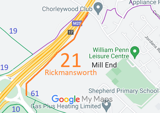
Map showing recorded Rickmansworth paths
Annotated map reproduced courtesy of Googlemaps.
This route starts on Long Lane (Rickmansworth 61 bridleway) and continues generally north-eastwards parallel to the M25 boundary to Shepherd's Lane (public road).

At the time of the 2023 Access Survey (18 Feb 23), the route was open and available for use with no obstructions. There was a 'public footpath' fingerpost at the junction with Shepherd's Lane and a waymark arrow at the junction with Long Lane (Rickmansworth 61 bridleway). There was a separate unsigned route used by riders and cyclists just north of the footpath steps at Shepherd's Lane.
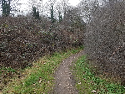
Photograph of Rickmansworth 21
View NW from Long Lane
Photo: Phil Wadey, 18 Feb 2023
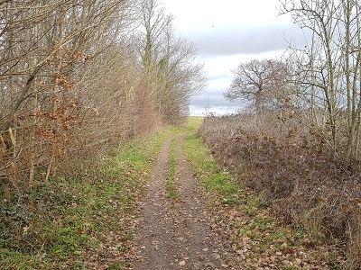
Photograph of Rickmansworth 21
Continuing NW
Photo: Phil Wadey, 18 Feb 2023
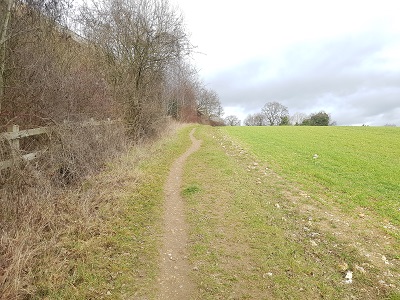
Photograph of Rickmansworth 21
Continuing NW
Photo: Phil Wadey, 18 Feb 2023
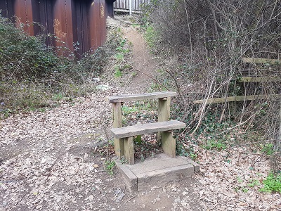
Photograph of Rickmansworth 21
Mounting Block at top of slope
Photo: Phil Wadey, 18 Feb 2023
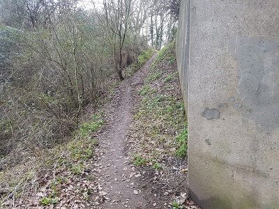
Photograph of Rickmansworth 21
View from Shepherd's Lane
Photo: Phil Wadey, 18 Feb 2023
BHS If you have ridden the route, please download a user evidence form and then follow the instructions and return the form to us. It only takes a few minutes to fill in (the whole form fits on one side of a piece of A4 paper). If you have any other questions, please email us.

Legal History
20 Jun 1953: Rickmansworth 21 was recorded as a footpath on the original definitive map and statement. DM sheet DM3-41 (TQ09SW).
31 Dec 1977: Rickmansworth 21 was shown as a footpath on the special review draft map and statement. DM sheet SR-88 (TQ09SW).
Definitive Statement (4 Dec 2015)
Path: [Rickmansworth] 21.  Recorded Status: Footpath.  Definitive Map sheet: 88
Commences from Long Lane thence NE along SE boundary of M25 to the junction with Shepherds Lane. Recommences from N side of Shepherds Lane approx 100m SE thence generally NE for approx 150m to The Queens Drive. The route then runs generally SE to the junction with Chiltern Drive.
Limitations: None

The junction with Rickmansworth 61 should be noted directly.

© 2023 Patchetts Green Bridleways Trust. File reference: EC1111.

Stats2