Patchetts Green Bridleways Trust
 PG: OBJECTS: PROMOTION: South Mimms [formerly Potters Bar] 71 BW
Map showing South Mimms 71 bridleway
Annotated map reproduced courtesy of Googlemaps.
This bridleway runs from Wash Lane to Dancers Lane, passing under the M25 motorway adjacent to the watercourse.

It has been designated by SUSTRANS as part of National Cycle Network (NCN) route 12, so cyclists are likely to be seen on the route.

At the time of the BHS 2023 Access Survey (3 Feb 23), no gates were across the path. It was signposted at each end.
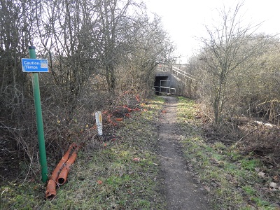
Photograph of South Mimms 71
View West from Wash Lane
Photo: Michael Rackham, 3 Feb 2023
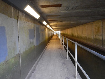
Photograph of South Mimms 71
Southwest, under M25 motorway
Photo: Michael Rackham, 3 Feb 2023
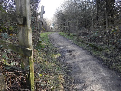
Photograph of South Mimms 71
Continuing southeastwards
Photo: Michael Rackham, 3 Feb 2023
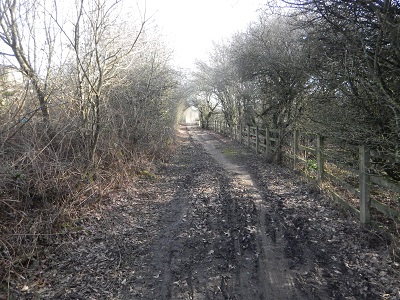
Photograph of South Mimms 71
Continuing southeastwards
Photo: Michael Rackham, 3 Feb 2023
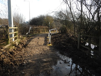
Photograph of South Mimms 71
Continuing SE to Dancers Lane
Photo: Michael Rackham, 3 Feb 2023
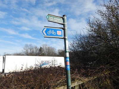
Photograph of South Mimms 71
Sign from Dancers Lane
Photo: Michael Rackham, 3 Feb 2023
BHS PGBT East Herts Footpath Society logo As part of the investigation into the the Wash Lane route, the gap between South Mimms 71 bridleway and Dancers Lane (public road) was identified. Hertfordshire County Council offered to add it to the List of Streets, and this was completed on 9 Mar 23. However, the 1971 Side Roads Order had set the 'gap' as a bridleway rather than a public road, and so the definitive map also needs to be updated. We have invited the council to add the missing 55m of bridleway to the map by a Legal Event Modification Order, to ensure the rights are recorded properly. This route was not at risk of loss on Path Extinguishment Day (1 Jan 26) because it became a bridleway in 1971 which is after 1 Jan 1949.

Legal History
9 Sep 1971: The London 'D' Ring Road (A1 - A111 Section Side Roads) Order 1971 created the path from Wash Lane to Dancers Lane when the M25 was constructed. (Site plan 1.)
This path is in South Mimms Parish from May 2008, when the South Mimms Parish was created by SI 2008/43. The path number remains the same.
9 Mar 2023: Gap on list of streets between South Mimms 71 BW and Dancers Lane public road filled in by Hertfordshire County Council. The Gazetteer Route ID is 4Y387/10.
24 Nov 2023: The Hertfordshire County Council (South Mimms 71) Legal Event Modification Order 2023 added the identified gap to the definitive map and statement.
Definitive Statement (1 Aug 2023)
Path: [South Mimms] 71.  Status: Bridleway.  Definitive Map sheet: 86
Commences at a junction with Wash Lane at Grid Ref: TQ 2328 9995, thence south-westwards to Grid Ref: TQ 2315 9993, thence generally south-westwards under the M25 Motorway to Grid Ref: TQ 2310 9985, thence generally eastwards alongside the motorway to Grid Ref: TQ 2332 9982, thence south-eastwards to Grid Ref: TQ 2334 9979 and a junction with Dancers Lane.
Width: 3.4m at TL23309983 widening to 4.4m at TL23329982 before narrowing to 2.8m at TL23349979
Limitations: None

The grid references seem to change from TQ to TL.

Previous Definitive Statement (10 Dec 2005)
Path: [South Mimms] 71.  Status: Bridleway.  Definitive Map sheet: 86
Commences at a junction with Wash Lane at Grid Ref: TQ2328 9995, thence southwestwards to Grid Ref: TQ2315 9993, thence generally south-westwards under the M25 Motorway to Grid Ref: TQ2310 9985, thence generally eastwards alongside the motorway to Grid Ref: TQ2331 9983, thence south-eastwards to Grid Ref: TQ2332 9982 and a junction with Dancers Lane.

© 2023 Patchetts Green Bridleways Trust