Patchetts Green Bridleways Trust
 PG: OBJECTS: PROMOTION: South Mimms Dyrham Lane
Map showing Dyrham Lane, South Mimms
Annotated map reproduced courtesy of Googlemaps.
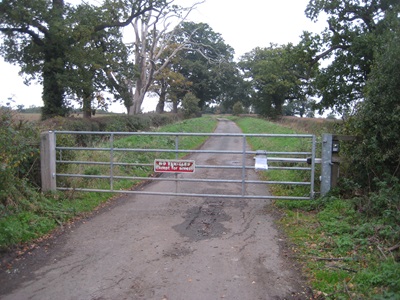
This route joins Trotters Bottom (public road) to the verge of the A1. The Highways Agency made sure that the verge was cleared for riders, and put in some protective crash barriers. The verge is used to go southwestwards towards the bridleway bridge over the A1. Photograph of Dyrham Lane
View N from Trotters Bottom
Photo: Phil Wadey, 28 Oct 2012
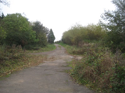
Photograph of Dyrham Lane
View SE from A1 Verge Route
Photo: Phil Wadey, 28 Oct 2012
BHS PGBTOn 19 March 2005, we made an application to record this route after reports of a gate across it. We now wait for it to be decided by the county council.

Legal History
20 Jun 1953: The route was not recorded on the original definitive map and statement.
19 Mar 2005: Application to record Dyrham Lane as a byway. HCC reference HTM/164.
2 May 2006: NERC exemption s.67(2)(b) as route not on DM but was on LOS.
1 May 2008: This path is in South Mimms Parish from May 2008, when the South Mimms Parish was created by SI 2008/43.
23 Oct 2023: Application made to the Secretary of State for a direction that Hertfordshire County Council determine the application by a set date.
15 Jan 2024: Secretary of State directed Hertfordshire County Council to determine the application by 15 Sep 2024. PINS reference ROW/3332666.
Application Process
Path Application Certificate Direction Inv Report Order Confirmed
EC182 19 Mar 2005 HTM/164 29 Oct 2012 15 Mar 2024 (6mo)      
[This route is not yet recorded on the definitive map and so there is no definitive statement.]
Maintainability
This route is maintainable at the public expense because it was a highway before 1835.

© 2025 Patchetts Green Bridleways Trust. File reference: EC182. HCC reference: HTM/164.

Stats2