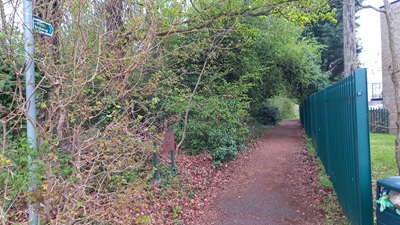
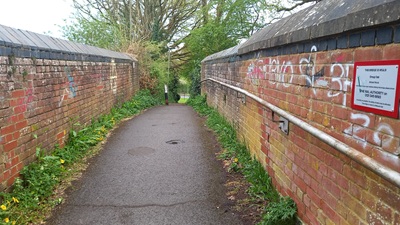
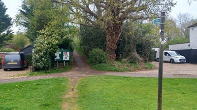
image of St Stephen 11 bridleway taken in 2025 showing path with fence to one side and trees to the other
 PG: OBJECTS: PROMOTION: ST ALBANS: St Stephen 11 BW
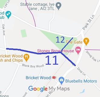
Map showing St Stephen 11 bridleway
Annotated map reproduced courtesy of Googlemaps.
The route runs from Station Road (county road) opposite Drop Lane (county road), over the narrow railway bridge to South Riding (county road). It has a junction with bridleway St Stephen 12.

At the time of the 2025 Access Survey (13 Apr 25), the path was unobstructed save for an authorised bollard on the southeastern side of the railway bridge (with adequate room to pass on a horse) and it was signposted ‘Public Bridleway’ at each end.

Photograph of St Stephen 11 bridleway
View from South Riding
Photo: Phil Wadey, 13 Apr 2025
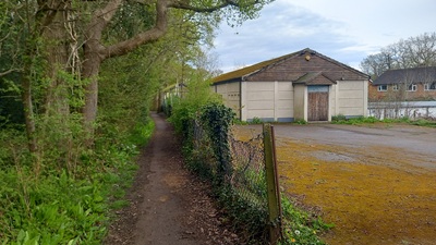
Photograph of St Stephen 12 bridleway
Continuing Eastwards
Photo: Phil Wadey, 13 Apr 2025
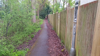
Photograph of St Stephen 12 bridleway
Continuing Eastwards
Photo: Phil Wadey, 13 Apr 2025
Photograph of St Stephen 12 bridleway
Southeast over Railway
Photo: Phil Wadey, 13 Apr 2025
Photograph of St Stephen 12 bridleway
View from Drop Lane
Photo: Phil Wadey, 13 Apr 2025
BHS PGBT As part of 1991 ARROW survey, we found that there was a gap between the recorded bridleway and Station Road. On closer examination, we found that this was due to a transcription error when the definitve map had been consolidated. We collected the evidence needed to apply for the route to be fully shown. At the time, the City and District of St Albans Council was acting as agent for the County Council. The City and District Council made the orders to record the additional length.

Legal History
20 Jun 1953: St Stephen 11 was recorded as bridleway on the original definitive map and statement. DM sheet DM3-30.
The City and District of St Albans (St Stephen 11) Modification Order 1998 contained errors and was not confirmed.
7 Apr 1999: The City and District of St Albans (St Stephen 11) (No 2) Modification Order 1999 (confirmed 1 Nov 2001) correctly reinstated the southern end of the path as a bridleway on the definitive map.
Application Process
Path Application Certificate Direction Inv Report Order Confirmed
EC1000 12 May 1997   Not Needed   7 Apr 1999 1 Nov 2001
Written Representations Timetable - FPS/B1930/7/4 and 5
Path Start Date OMA SOC Other SOCs POEs Inquiry Result
EC156           Confirmed
Definitive Statement (4 Dec 2015)
Path: [St Stephen] 11.  Status: Bridleway.  Definitive Map sheet: 76
Commences from County Road (South Riding) thence E to a junction with BR12 (at TL 13515  02155) thence SE over the railway via a bridge to the edge of Bricket Wood Common (at TL 13575  02105) then across the Common to join the County Road (Station Road (at TL 13590 02095) opposite Drop Lane.
Width: Minimum 2.5 metres between TL 13515 02155 and TL 13575 02105, 4 metres between TL 13575 02105 and TL 13590 02095.
Limitations:
Maintainability
This route is maintainable at the public expense because it was a footpath or bridleway existing before 30 Apr 1959.

© 2025 Patchetts Green Bridleways Trust. File reference: EC156. HCC reference: STA/53.

Stats2