| Patchetts Green Bridleways Trust | ||
| PG: OBJECTS: PROMOTION: St Stephen 96: Featherbed Lane (East) | ||
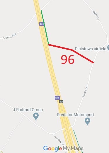
![]() Annotated map reproduced courtesy of Googlemaps. |
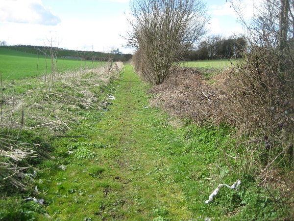
Featherbed Lane is an old road which was severed by the M1 motorway. The recorded route runs from Blunts Lane, along the line of the old road until it stops at the boundary of the M1. Then, there is a wide track northwards that enables walkers, riders and cyclists to reach Bedmond Lane. |
Looking westwards along routePhoto: Phil Wadey, April 2010 |
This route was identified as not recorded on the definitive map when members of the Patchetts Green Riding Club surveyed the riding routes in the area as part of the British Horse Socety’s Access and Riding Rights of Way survey in 1991. An application was made in 1997 to record the route, and the route was finally recorded in 2018.
|
||
| Legal History 1 Feb 1997: Definitive Map Modification Order application made to record this route. 18 Jan 2017: Secretary of State directed Hertfordshire County Council to make a decision on the application by 18 Jan 2018. FPS/M1900/14D/2. 29 Sep 2017: The Hertfordshire County Council (St Stephen 96) Modification Order 2017 (confirmed 26 Jan 2018) added this route to the definitive map as a byway for open to all traffic.
|
Definitive Statement (17 May 2017)
Path: [St Stephen] 96. Status: Byway Open to All Traffic Definitive Map sheet: 76 Featherbed Lane (East). Commences from Blunts Lane (public highway) at TL 1173 0447 running along Featherbed Lane NW for approx 190m to junction with FP36a at TL 1156 0456. Continuing WNW for approx 265m to the E embankment of the M1 at TL 1131 0463. Width: Varies between 5.5m and 10m as shown in the Hertfordshire County Council (St Stephen 96) Modification Order 2017. Limitations: None. |
© 2024 Patchetts Green Bridleways Trust. File reference: EC157. HCC reference: STA/49.