| Paths Greenways Bridleways Tracks | ||
| PG: OBJECTS: PROMOTION: Thorley 1 (recorded FP but believed to carry higher rights) | ||
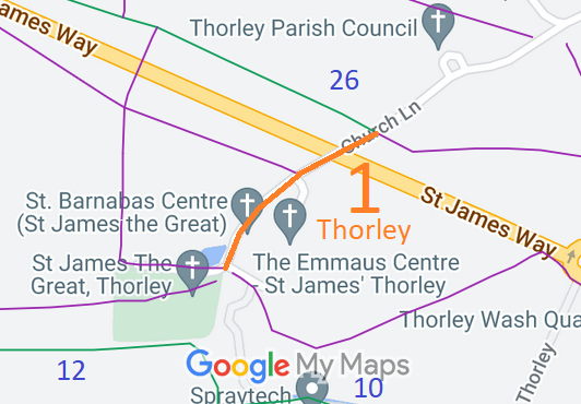
![]() Annotated map reproduced courtesy of Googlemaps. |
This route starts at the junction with Church Lane and Thorley 26 bridleway and runs generally southwestwards to end at a junction with three Thorley footpaths. This is not far from Thorley 12 bridleway and so we hope to link them up in due course when opportunities permit.
At the time of the 2023 Access Survey (18 Aug 23), the path was unobstructed, but there was no signage at either end. |
|||
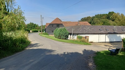
![]() View along path from Church Photo: Phil Wadey, 18 Aug 2023 |
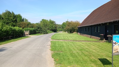
![]() Continuing NE Photo: Phil Wadey, 18 Aug 2023 |
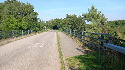
![]() Continuing NE on Overbridge Photo: Phil Wadey, 18 Aug 2023 |
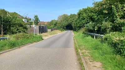
![]() Continuing NE Photo: Phil Wadey, 18 Aug 2023 |
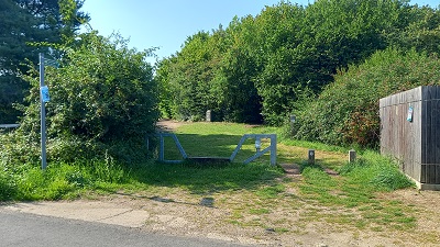
![]() Junction Bridleway 26 Photo: Phil Wadey, 18 Aug 2023 |
| Legal History 2 Feb 1953: The relevant part of Thorley 1 was not recorded on the original definitive map and statement. DM sheet DM1-22 (Herts 23 SW). 31 Dec 1977: The route was not shown on the special review draft map and statement. DM sheet SR-48 (TL41NE). 2 May 2006: NERC exemption s.67(2)(a) as main use 2000-2006 was for mechanically propelled traffic (if considered as part of width of road). 14 Feb 1996: The East Hertfordshire District Council (Definitive Footpaths 1, 14, 15 and 16 Thorley) Public Path Diversion Order 1996, confirmed 21 Apr 1997, put part of Thorley 1 FP along Church Lane. 21 May 1999: The Hertfordshire County Council (Thorley Development) Legal Event Modification Order 1999 recorded the effect of the 1996 diversion order and others, to record part of Thorley 1 FP along Church Lane. 12 Aug 2023: Application to upgrade the part of Thorley 1 FP along Church Lane to restricted byway. HCC reference EH/534. |
Definitive Statement (4 Dec 2015)
Path: [Thorley] 1. Recorded Status: Footpath. Definitive Map sheet: 48 Commences at junction with London Road opposite the "Gate" P.H. with a stile thence NW over culvert and over field gate to stile thence generally NW to county road at TL 4801 1898. Recommences on W side of county road at TL 4799 1898 thence generally W to county road Church Lane at TL 4776 1900 thence generally SW along SE side of Church Lane to junction with FPs 28, 1 and 13 at TL 4763 1887. Width: Minimum 2m between TL 4779 1898 and TL 4770 1896. Reference to FP 1 in last line should be to FP 3. |
|
Location Information
Postcode for SATNAV for anyone inspecting path: CM23 4BE. |
© 2023 Patchetts Green Bridleways Trust. File reference: EC739. HCC reference: EH/534.