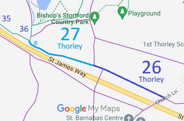
Annotated map reproduced courtesy of Googlemaps.
We need a volunteer to photograph this route for this year's Access and Riding Rights of Way Survey. It's easy - just take photographs (safely) when you use the path. Find out more!
| Paths Greenways Bridleways Tracks | ||
| PG: OBJECTS: PROMOTION: Thorley 26 and 27 | ||
| Thorley 27 is the subject of a Temporary Traffic Regulation Order, effective 8 May 25 and valid for up to 18 months to allow bridge replacement. Do not use in this period if the route is marked on site as closed. | ||
Annotated map reproduced courtesy of Googlemaps. |
This bridleway starts as Thorley 26 from Church Lane (public road) and continues generally northwestwards, changing to Thorley 27 until it ends at the junction of
Thorley 35 bridleway and
Thorley 36 bridleway.
We need a volunteer to photograph this route for this year's Access and Riding Rights of Way Survey. It's easy - just take photographs (safely) when you use the path. Find out more! |
|
| ||||||||
© 2025 Patchetts Green Bridleways Trust.
