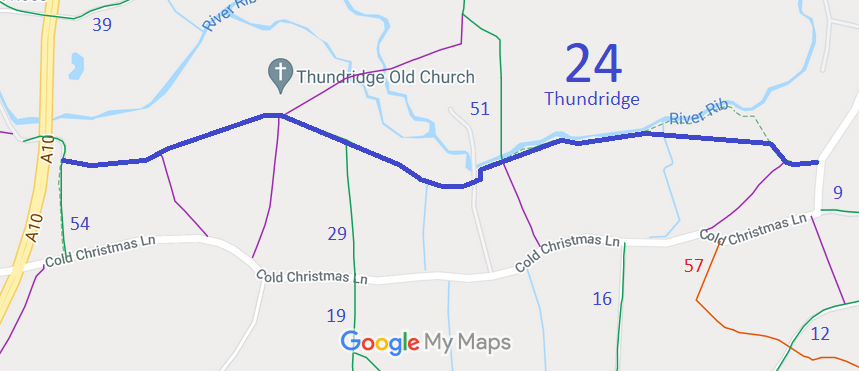
Annotated map reproduced courtesy of Googlemaps.
We need a volunteer to photograph this route for this year's Access and Riding Rights of Way Survey. It's easy - just take photographs (safely) when you use the path. Find out more!
| Paths Greenways Bridleways Tracks | ||
| PG: OBJECTS: PROMOTION: Thundridge 24 | ||
Annotated map reproduced courtesy of Googlemaps. |
This route starts from Thundridge 54 bridleway and continues generally eastwards through junctions with Thundridge 29 bridleway and Thundridge 51 bridleway, to end on Cold Christmas Lane.
We need a volunteer to photograph this route for this year's Access and Riding Rights of Way Survey. It's easy - just take photographs (safely) when you use the path. Find out more! |
| Legal History 24 Feb 1976: The Hertfordshire County Council (Bridle Paths Nos. 24 and 32 and FP 30 Thundridge Parish and BR 64 Standon Parish) Bridle Paths and Footpath Diversion Order 1976 order was made. 24 Feb 1976: London Gazette announcement of making the order. |
Definitive Statement (4 Dec 2015)
Path: [Thundridge] 24. Status: Bridleway. Definitive Map sheet: 46 Commences at county road along Church Lane E of the Mountains thence generally W along S bank of River Rib thence NW to St Mary and All Saints Church thence SW to join county road E of Ducketts Wood. The statement should refer to the junction with Thundridge 54 BW at its western end |
© 2022 Patchetts Green Bridleways Trust.
