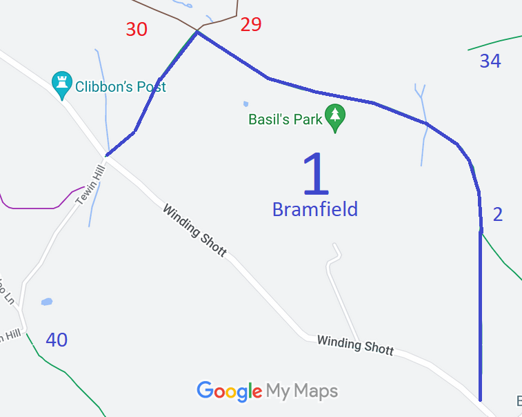
Annotated map reproduced courtesy of Googlemaps.
We need a volunteer to photograph this route for this year's Access and Riding Rights of Way Survey. It's easy - just take photographs (safely) when you use the path. Find out more!
| Paths Greenways Bridleways Tracks | ||
| PG: OBJECTS: PROMOTION: Bramfield 1 | ||
Annotated map reproduced courtesy of Googlemaps. |
This route starts on Winding Shott (public road), and heads generally northwards to a juncction with Bramfield 2 bridleway. It continues north then northwestwards to junctions with Watton at Stone 29 byway and Watton at Stone 30 byway before turning southwestwards and ending on Winding Shott (public road) opposite Tewin Hill (public road).
We need a volunteer to photograph this route for this year's Access and Riding Rights of Way Survey. It's easy - just take photographs (safely) when you use the path. Find out more! |
|
| |||||||||
© 2024 Patchetts Green Bridleways Trust.
