Paths Greenways Bridleways Tracks
 PG: OBJECTS: PROMOTION: Bramfield 6a and 13 (part) and Tewin 25
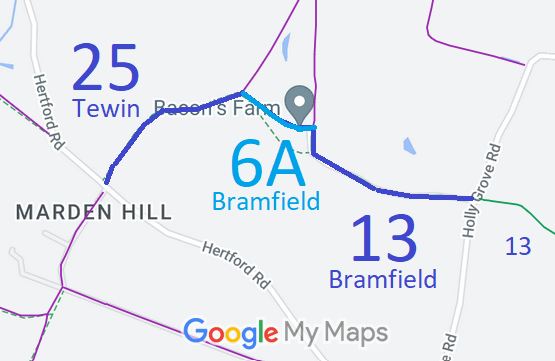
Map showing recorded Bramfield and Tewin paths
Annotated map reproduced courtesy of Googlemaps.
This route starts on Holly Grove Lane (public road) opposite another part of Bramfield 13 bridleway and heads generally westwards then north to become Bramfield 6A, then westwards to become Tewin 25 at the parish boundary. It then continues southwestwards to Hertford Road (public road) at Marden Hill.

We need a volunteer to photograph this route for this year's Access and Riding Rights of Way Survey. It's easy - just take photographs (safely) when you use the path. Find out more!

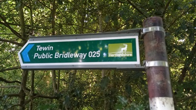
Sign where Tewin 25 meets Hertford Road
Sign at Hertford Road
Photo: Phil Wadey, 25 Jun 2024

Legal History
2 Feb 1953: Tewin 25 was recorded as a bridleway on the original definitive map and statement. DM sheets DM2-20 and DM2-22.
Definitive Statement (4 Dec 2015)
Path: [Bramfield] 6a.  Status: Bridleway.  Definitive Map sheet: 58
Commences at junction with FP5 S of Bacons Farm thence NW to parish boundary.

Statement should refer to juntion with Bramfield 13 BW and with Tewin 25 BW.

Path: [Bramfield] 13.  Status: Bridleway.  Definitive Map sheet: 58
Commences from Bacons Farm at junction with FP5 thence SE across county road to join BR11 (Hertingfordbury) at SW corner of Charterfield Plantation at parish boundary thence along said boundary to Archers Spring.

Path: [Tewin] 25.  Status: Bridleway.  Definitive Map sheet: 58
Commences at junction with county road (C49) opposite Marden Hill thence generally NE skirting NW boundary of Red Wood thence NE to parish boundary.

Statement should refer to junction with Bramfield 6A BW.
Maintainability
This route is maintainable at the public expense because it was a footpath or bridleway existing before 30 Apr 1959.

© 2024 Patchetts Green Bridleways Trust.

Stats2