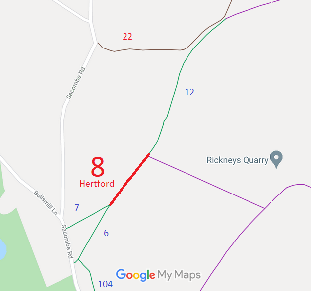
Legal History
2 Feb 1953: The route was recorded as CRF (Carriage Road used as a Footpath) on the original definitive statement. DM sheet DM2-21 (Herts 29 NE).
31 Dec 1977: Hertford 8 was shown as a footpath on the special review draft map and statement, but objections were received and it remained a Road Used as a Public Path (RUPP). DM sheet SR-59 (TL31SW).
2 May 2006: Restricted Byway rights were confirmed or created on this path by virtue of ss 47 and 48 Countryside and Rights of Way Act 2000.
30 Apr 1993: An application was made to downgrade to bridleway. HCC reference EH/36.
|
Definitive Statement (4 Dec 2015)
Path: [Hertford] 8. Status: Restricted Byway.
Definitive Map sheet: 45
To Chapmore End (continuation BRs 6 and 7). Starts from gap in hedge, follows at slight
angle to far corner of field.
|