
| PG: OBJECTS: PROMOTION: Ridge 34 | |
| London Orbital Bridleroute: Anti-clockwise: Blackhorse Lane to Blackhorse Lane Verge. Clockwise: Blackhorse Lane to Ridge 10. | H25 |
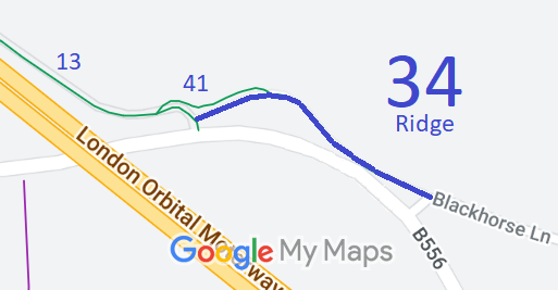 Annotated map reproduced courtesy of Googlemaps. |
Bridleway 34 Ridge starts from Ridge 13 bridleway, at its junction with the old A6, and continues generally eastwards along the route of the former road to a junction with Ridge 41 and then east and southeastwards to Blackhorse Lane.
At the time of the BHS 2022 Access Survey (6 Jan 2023), there were no gates across the path but there were suitably-spaced bollards at the western end. The route was clear throughout although for part of its length a fence had fallen on the ground, taking up useful width. There were council fingerposts at each end, but only the older one had the 'H25' patch. |
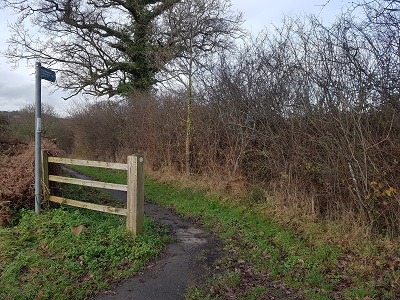 View west from Blackhorse Lane Photo: Phil Wadey, 6 Jan 2023 | ||
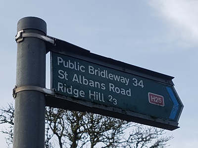 Sign at Blackhorse Lane end Photo: Phil Wadey, 6 Jan 2023 |
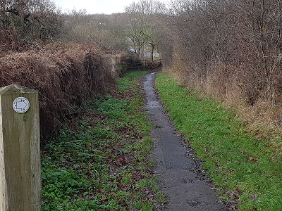 Looking NW Photo: Phil Wadey, 6 Jan 2023 |
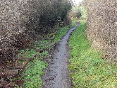 Continuing NW Photo: Phil Wadey, 6 Jan 2023 |
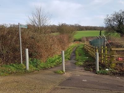 View East from Ridge 13 Photo: Phil Wadey, 6 Jan 2023 |
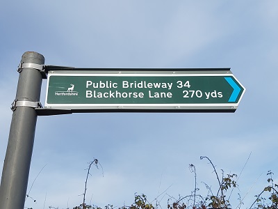 Sign at Ridge 13 junction Photo: Phil Wadey, 6 Jan 2023 |
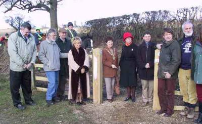 Official opening of Ridge 34 BW Photo: Chris Beney, 23 Feb 2001 |

 This route was the old line of the road, before it was straightened
when the M25 was built. The old section of road was fenced at each
end when the new road opened, and as it was legally stopped up, the
ownership reverted to the adjoining landowners. They were persuaded
by the British Horse Society's local access officer, to
rededicate at bridleway status, in order to help with the safety of
walkers, riders and cyclists on the H25 London Orbital Bridleroute.
The British Horse Society funded the legal costs associated with the dedication.
Our thanks go to the BHS, the landowners and the borough council! 
|
|||
 Riders on Ridge 34 BW Photo credit: Phil Wadey, 8 Jan 2004 |
Legal History 1 Nov 2000: A Public Path Creation Agreement between Hertsmere Borough Council and the Trustees of the Tyttenhanger Estate created this path as a public bridleway. 23 Nov 2000: The Hertfordshire County Council (Ridge 34) Legal Event Modification Order 2000 added the path to the definitive map and statement. |
Definitive Statement (4 Dec 2015)
Path: [Ridge] 34. Status: Bridleway. Definitive Map sheet: 78 Commences from a junction with BR13 at TL 2101 0217 and running in a generally easterly direction for approx. 70m to junction with BR41 at TL 2108 0220 and continuing for approx. 170m to a junction with Blackhorse Lane at TL 2122 0211. Width: 4m. Limitations: The owner or tenant of the land over which the bridleway passes has the right to maintain a width limitation by using bollards or other means at or within 10m of the start and finish of the path so however that the clear width of the bridleway at the bollards shall not be less than 5 feet (1.52m). |
© 2023 Patchetts Green Bridleways Trust.
File reference: EC465.
