Patchetts Green Bridleways Trust
 PG: OBJECTS: PROMOTION: St Stephen 6 BW and UUCR3
London Orbital Bridleroute: Anti-clockwise: Smug Oak Lane then St Stephen 74. Clockwise: St Stephen 73.  H25 
We're collecting user evidence for the council now: Download user evidence form - Read the Instructions
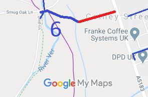
Map showing St Stephen 6 bridleway
Annotated map reproduced courtesy of Googlemaps.
St Stephen 6 bridleway (shown with a thick blue line) runs from Smug Oak Lane, Bricket Wood, generally east-south-east to a track (shown red) that leads to Radlett Road in Colney Street, almost opposite St Stephen 73. The track is recorded as a county road.

At the time of the BHS 2022 Access Survey (3 Apr 22), no gates were across the path and it was signposted at each end.

Photograph of St Stephen 6
View from Smug Oak Lane
Photo: Helen Taylor, 3 Apr 2022
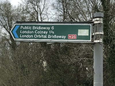
Photograph of St Stephen 6
Sign at Smug Oak Lane
Photo: Helen Taylor, 3 Apr 2022
Photograph of St Stephen 6 bridleway taken on 15 August 2007
St Stephen 6 Bridleway
Photo: Phil Wadey, 15 August 2007
Photograph of St Stephen 6
Bollards at BW 6 to UCR changeover
Photo: Helen Taylor, 3 Apr 2022
Photograph of St Stephen 6
Half way along overall path
Photo: Helen Taylor, 3 Apr 2022
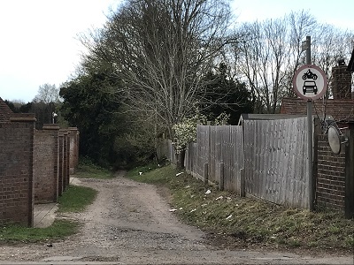
Photograph of St Stephen 6
View from Radlett Road
Photo: Helen Taylor, 3 Apr 2022
Photograph of St Stephen 6
SIgn at Radlett Road end
Photo: Helen Taylor, 3 Apr 2022
BHS PGBT The track from St Stephen 6 to Radlett Road (shown red) was identified as an unrecorded route by the Patchetts Green Riding Club when performing the British Horse Society's 1991 ARROW survey. An application has been made to record this on the definitive map.
If you have ridden or cycled the route, please download and print a user evidence form and then follow the instructions and return the form to us. It only takes a few minutes to fill in (the whole form fits on one side of a piece of A4 paper). If you have any other questions, please email us.

Legal History
1938: St Stephen 6 BW is shown as a bridleway (blue dots) on the Hertfordshire County Council ROW survey. Map St Albans Rural 16.
1938: The unrecorded route was shown as an unclassified road (brown line) on the Hertfordshire County Council ROW survey. Map St Albans Rural 16.
18 Jun 1997: The City and District of St Albans (St Stephen 6) Modification Order 1997 (confirmed 11 Mar 1998) recorded a width for St Stephen 6.
22 Mar 2010: Application for unrecorded section made to Hertfordshire County Council. Awaiting determination.
Application Process
Path Application Certificate Direction Inv Report Order Confirmed
EC152 1 May 1993 Not recorded Not needed SADC Cttee 18 Jun 1997 11 Mar 1998
EC120 22 Mar 2010 STA/132 14 Apr 2010        
Definitive Statement (4 Dec 2015)
Path: [St Stephen] 6.  Status: Bridleway  Definitive Map sheet: 77
Commences at junction with Smug Oak Lane (TL1503 0224) thence generally eastwards to a junction with BW 74 (TL1504 0224) thence over the River Ver thence generally east south east past a junction with FP 54 (TL1508 0225) to end of county road number 6U 1584 (TL1526 0219) leading to Colney Street
Width: Varies between 4m and 10m as shown more precisely cross hatched on the plan contained in 'The City and District of St Albans (St Stephen 6) Modification Order 1997'.
Maintainability
The UCR route is maintainable at the public expense because it was a highway before 1835.
St Stephen 6 BW is maintainable at the public expense because it was a footpath or bridleway existing before 30 Apr 1959.

© 2024 Patchetts Green Bridleways Trust. File references: EC152 (St Stephen 6), EC120 (unrecorded route).

Stats2