Patchetts Green Bridleways Trust
 PG: OBJECTS: PROMOTION: St Stephen 74 BW
London Orbital Bridleroute: Anti-clockwise: Drop Lane then St Stephen 10. Clockwise: Smug Oak Lane then St Stephen 6.  H25 

Map showing recorded St Stephen paths
Annotated map reproduced courtesy of Googlemaps.
The route runs from Riverside Way, off Drop Lane, and leads to Smug Oak Lane, near the junction with bridleway St Stephen 6, and bridleway St Stephen 65.

This path was dedicated by the owners, Mr & Mrs Guard, because "they saw some girls crossing the road and struggling with Smug Oak Lane". Mr Guard contacted the County Council himself to make the dedication.

At the time of the 2023 Access Survey (8 Sep 23), there were no obstructions across the path. It was signposted where it met Smug Oak Lane (public road).
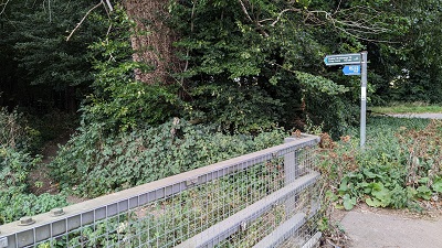
Photograph of St Stephen 74 bridleway
View from Smug Oak Lane
Photo: Michael Rackham, 8 Sep 2023
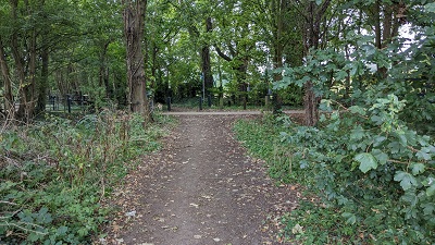
Photograph of St Stephen 74 bridleway
Approaching Riverside Way
Photo: Michael Rackham, 8 Sep 2023

Legal History
20 Jun 1953: The route was not recorded on the original definitive map and statement.
31 Dec 1977: The route was not shown on the special review draft map and statement. DM sheet SR-77.
20 Dec 1995: Dedicated by Mr & Mrs Guard via a s.38(3) agreement with Hertfordshire County Council.
Definitive Statement (19 Apr 2010)
Path: [St Stephen] 74.  Status: Bridleway.  Definitive Map sheet: 77
Commences from county road Smug Oak Lane and junction with BR6 at TL 1504 0225 thence generally SW for 45m to Riverside Way at TL 1503 0221.
Width: 3m.
Limitations: None.
Maintainability
This route is maintainable at the public expense by virtue of s.36(2)(d) Highways Act 1980 as it was created by a Public Path Creation Agreement. [Dedicated by PPCA]
Location Information
Postcode for SATNAV for anyone inspecting path: AL2 3TX (Riverside Way car park, Drop Lane).

© 2025 Patchetts Green Bridleways Trust. File reference: EC147.

Stats2