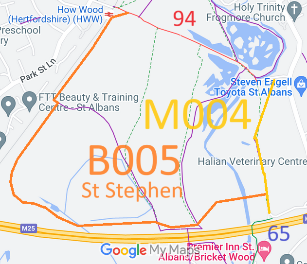
Annotated map reproduced courtesy of Googlemaps.
The prefix 'M' in M004 indicates that this is planned to be a multi-user surfaced route with status bridleway. Those new routes prefixed with 'B' will be unsurfaced bridleways.
| Paths Greenways Bridleways Tracks | ||
| PG: OBJECTS: PROMOTION: St Stephen proposed new route M004 (as part of Railfreight changes) | CMP6 | |
Annotated map reproduced courtesy of Googlemaps. |
The proposed route would start from St Stephen 65 BW and continue generally northwards to a junction with proposed route B005. It will continue generally north and northeastwards to end on St Stephen 84 restricted byway (Hyde Lane). Taken with Hyde Lane and proposed route B005, this make a nice circular route.
The prefix 'M' in M004 indicates that this is planned to be a multi-user surfaced route with status bridleway. Those new routes prefixed with 'B' will be unsurfaced bridleways. |
|||
| Legal History 29 Oct 2006: M004 approximate route shown as proposed bridleway in planning application 5/2006/1680 document 520061680_02. |
Definitive Statement (4 Dec 2015)
Path: [St Stephen] 17. Recorded Status: Footpath. Definitive Map sheet: 77 Commences at junction with county road just E of River Ver thence SW and S to junction with BR65 at Mill Lane. |
© 2024 Patchetts Green Bridleways Trust.
