Paths Greenways Bridleways Tracks
 PG: OBJECTS: PROMOTION: Woolmer Green 9
Map showing recorded Woolmer Green paths
Annotated map reproduced courtesy of Googlemaps.
This route starts from White Horse Lane (public road) opposite Robbery Bottom Lane, and heads generally eastwards to join Datchworth 11 restricted byway at the parish boundary.

At the time of the 2024 Access Survey (27 Aug 24), there were no obstructions across the path and it was signposted where it met the metalled road. There was a waymark at the parish boundary.
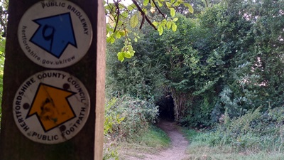
Photograph of Datchworth 11 and Woolmer Green 9
Waymark at Parish Boundary
Photo: Phil Wadey, 27 Aug 2024
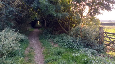
Photograph of Woolmer Green 9
Continuing Westwards
Photo: Phil Wadey, 27 Aug 2024
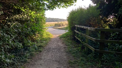
Photograph of Woolmer Green 9
Approaching White Horse Lane
Photo: Phil Wadey, 27 Aug 2024
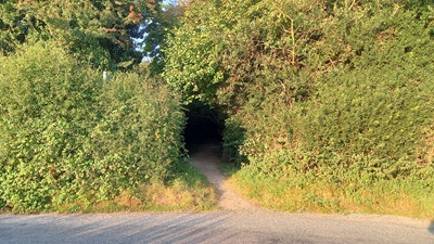
Photograph of Woolmer Green 9
View from White Horse Lane
Photo: Phil Wadey, 27 Aug 2024
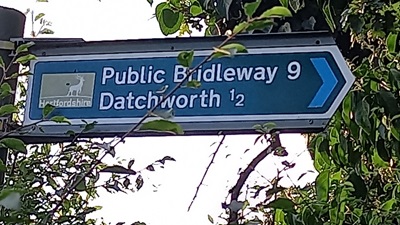
Photograph of Woolmer Green 9
Sign at White Horse Lane
Photo: Phil Wadey, 27 Aug 2024
BHS PGBT As part of the Patchetts Green Bridleways Trust's and British Horse Society's work to record paths before Path Extinguishment Day, it was spotted that there was good evidence that this route was actually an old road, and so should be recorded as a restricted byway. The historical evidence showed a continuous route with Datchworth 11 restricted byway, so an application was made in 2016 to record it as a restricted byway.

Legal History
1837: Woolmer Green 9 was shown on the Welwyn tithe map as not subject to an apportionment.
2 Feb 1953: Welwyn 9 was recorded as a bridleway on the original definitive map and statement. DM sheet DM2-07 (Herts 20 SE).
17 Dec 1968: Welwyn Rural District Council - Parish of Welwyn No.1 Bridleway Extinguishment Order 1968 would have extinguished the bridleway, but it was not confirmed. [HA59] HCC reference DM2/103.
31 Dec 1977: Welwyn 9 was shown as a bridleway on the special review draft map and statement. DM sheet SR-44 (TL 21 NE).
In 2000, Welwyn 9 was renumbered Woolmer Green 9 when Woolmer Green civil parish was created.
5 Dec 2016: Application to record as restricted byway. HCC reference WH/108.
Definitive Statement (4 Dec 2015)
Path: [Woolmer Green] 9.  Status: Bridleway.  Definitive Map sheet: 44
Commences at junction with Woolmer Green - Burnham Green Road N of Ironbox Plantation thence generally E to parish boundary.

Statement omits to mention junction with Datchworth 11 RB.

Maintainability
This route is maintainable at the public expense because it was a footpath or bridleway existing before 30 Apr 1959.

© 2024 Patchetts Green Bridleways Trust.

Stats2