Legal History
31 Dec 1977: Potters Bar 39 was shown as a footpath on the special review draft map and statement.
|
|
Definitive Statement (4 Dec 2015)
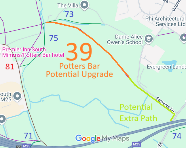
Path: [Potters Bar] 39. Recorded Status: Footpath.
Definitive Map sheet: 78
Starts at stile by fieldgate at the eastern end of drive to Bridgefoot House, passes over
concrete bridge with brick parapet and along the drive for a few yards to another stile, across
Bridgefoot Lane and over a third stile into meadow. The path continues south east to the
south east corner of the meadow over a stile across a second meadow to a fifth stile in the
south east corner and then along the east side of a third meadow, over a short length of a cart
track between hedges and ends on the west side of Sawyers Lane about 430 yards from its
junction with Baker Street.
|
Maintainability
Potters Bar 39 is maintainable at the public expense because it was a footpath or bridleway existing before 30 Apr 1959.
|
|