
- Welwyn 11 BW, from BW 12 to Wych Elm Lane/Bridge Road, Woolmer Green
- Welwyn 12 BW/BOAT, from Heath Road to Ninnings Lane
- Welwyn 18 BOAT, Roundabout Lane, from Briary Wood Lane to Hangmans Lane
- Welwyn 22 BOAT, Larch Lane, off Robbery Bottom Lane
- Welwyn 26 and Woolmer Green 24 and 26 BW
- Welwyn 28 BOAT, Turpin's Lane to line of railway
- Welwyn 36 and Tewin 6 BW, from Pennyfather Lane to Tewin 1 Byway
- Welwyn 37 and Tewin 7 BW, from Harmer Green Lane to Churchfield Road
- Welwyn 50 BW, from Welwyn 36 BW to Pennyfather Lane
- Welwyn 33, 34 and Tewin 38 (RB status applied for)
- Welwyn 38 Recorded as FP, believed BW, under investigation
- Welwyn Ninnings Lane, under investigation

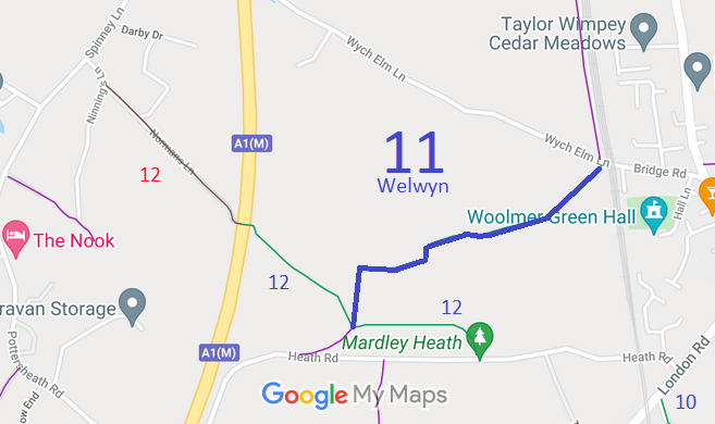


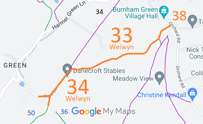
Annotated maps reproduced courtesy of Googlemaps.



 Local Government: Formerly within Welwyn Rural District. From 1974, part of Welwyn Hatfield District.
In 2000, the area known as Woolmer Green separated and became its own civil parish.
Inclosure (1805). Inclosure (1819) [Codicote, Welwyn and Knebworth]. Tithe (Digswell) (1841) DSA4/35/2. Tithe (Welwyn) (1837) DSA4/113/2.
