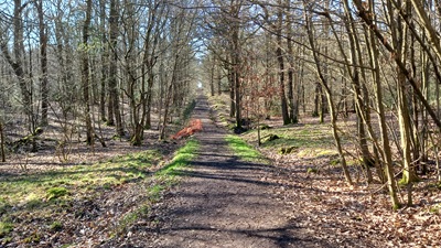
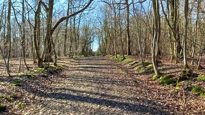
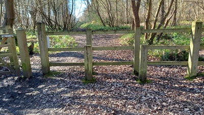
image of Hoddesdon 73 bridleway taken in 2025 showing well defined track through the woods
 PG: OBJECTS: PROMOTION: Hoddesdon 73
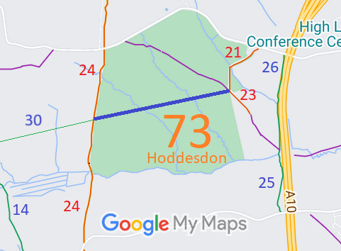
Map showing recorded Hoddesdon paths
Annotated map reproduced courtesy of Googlemaps.
This path starts at the junction of Hoddesdon 21 restricted byway and Hoddesdon 23 restricted byway, and heads generally westwards to end on Brickendon Liberty 24 restricted byway, opposite Brickendon Liberty 30 bridleway.

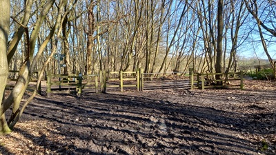
At the time of the 2025 Access Survey (2 Mar 25), the path was obstructed at each end by post and rail fencing so that the path could not be used, and there was no bridleway signage in place. Note: 27 Mar 26, Hertfordshire County Council report that both ends are now open for use.

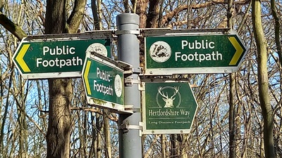
Photograph of Hoddesdon 73 bridleway
Signage at Eastern End
Photo: Phil Wadey, 2 Mar 2025
Photograph of Hoddesdon 73 bridleway
Look Back at Eastern End
Photo: Phil Wadey, 2 Mar 2025
Photograph of Hoddesdon 73 bridleway
Continuing Westwards
Photo: Phil Wadey, 2 Mar 2025
Photograph of Hoddesdon 73 bridleway
Continuing Westwards
Photo: Phil Wadey, 2 Mar 2025
Photograph of Hoddesdon 73 bridleway
Junction with Ermine Street
Photo: Phil Wadey, 2 Mar 2025
BHS As part of the British Horse Society's work to record paths it was spotted that a route used by the public was not shown on the official record of public rights of way. A public meeting was held so that users of the route could attend to fill in user evidence forms. These were then collated and submitted to the County Council, which agreed with the application and made an order to record the bridleway. The landowner, the Woodland Trust, did not oppose the application. The order also made other changes to the definitive map, and objections were made, so this part of the order was held up. The order was confirmed on 4 Sep 24, so confirming the public right on foot and on horse on this track.

Legal History
2 Feb 1953: The route was not recorded on the original definitive map and statement.
31 Dec 1977: The route was not shown on the special review draft map and statement. DM sheet SR-85.
8 Jun 2016: Application made to record the route as a bridleway. HCC reference BRX/50.
20 Jul 2018: The Hertfordshire County Council (Hoddesdon 73 and Brickendon Liberty 30) Modification Order 2018 (confirmed 4 Sep 2024) added this route to the definitive map and statement as a bridleway.
Application Process
Path Application Certificate Direction Inv Report Order Confirmed
EC381A 8 Jun 2016 BRX/50 Submitted Not Required 31 Mar 2017 20 Jul 2018 4 Sep 2024
Inquiry Timetable
Path Start Date OMA SOC Other SOCs POEs Inquiry Result
EC381A 8 Jan 2024 4 Mar 2024 15 Apr 2024 18 Jun 2024 16-19 Jul 2024 4 Sep 2024
2 Mar 2025: Incorrect council signage reported to Broxbourne Borough Council by email.
2 Mar 2025: Obstructing fences reported to the landowners by email with a request for removal.
4 Mar 2025: No response from Broxbourne BC, so signage issue reported on HCC's online tool. Reference: 401004568853.
27 Mar 2026: HCC reports that the obstructing fences have been removed.
Definitive Statement (6 Jul 2018)
Parish: [Hoddesdon] 73.  Status: Bridleway.  Definitive Map sheet: 85
Commences from RBs 21 and 23 and FP 22 at TL 3547 0854 then runs SW along track through Hoddesdonpark Wood for approx. 200m to cross culvert at TL 3527 0849 and continues SW along track through woodland for approx. 270m to cross culvert at TL 3501 0843. Continues SW along track through woodland for approx. 290m to parish boundary, joining Brickendon Liberty RB24 and BR 30 at TL 3473 0837.
Width: 3m.
Limitations: A gate and gap at TL 3473 0837.

© 2025 Patchetts Green Bridleways Trust. File reference: EC381. HCC reference: BRX/50.

Stats2